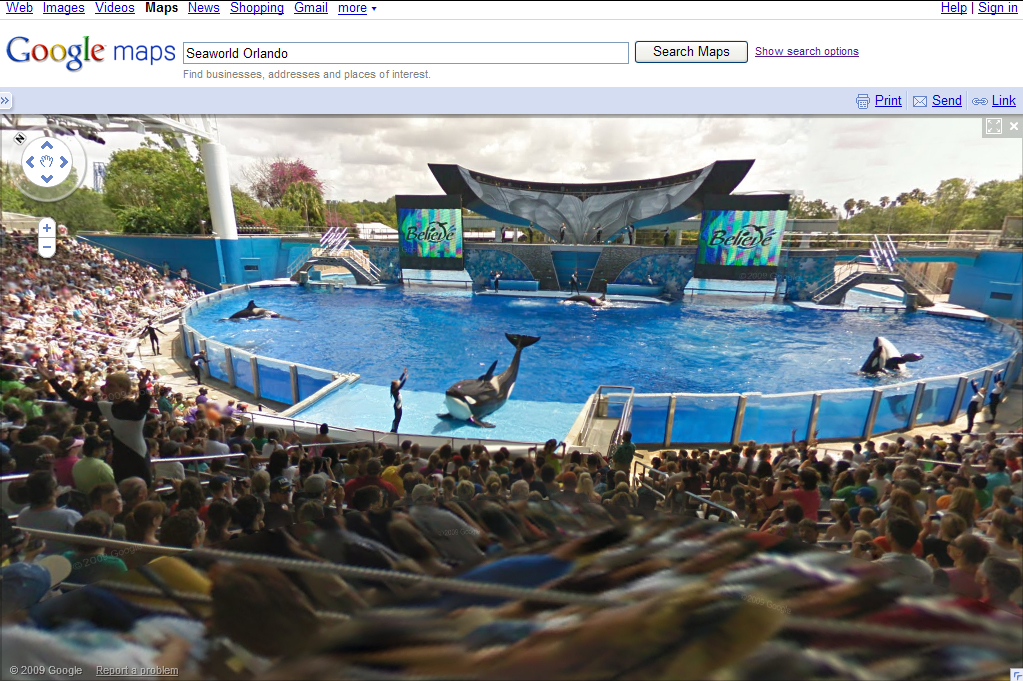
Google Street View now available for SeaWorld

We previously told you about being able to virtually walk through the streets of the Universal Orlando Resort via Google Maps. Now SeaWorld parks in Orlando, San Antonio and San Diego have also been captured by Google and are navigable via their Street View technology.
From worldsofdiscoveryblog.com:
Working with Google’s Street View team, nearly every inch of the parks was mapped using one of Google’s “Trikes.” A state-of-the-art camera automatically gathered photographs from the back of a modified bicycle. Google software then blended the images, creating the famous, interactive and completely moveable 360-degree scenes Street View is known for.
And the best way to make sure every show, splash, adventure and fave world-class thrill ride was mapped? The 250-pound Trike, complete with camera and GPS mounted on a mast, was pedal-powered by a Google staff member. It’s the ultimate mix of technology — both high and low.
Soon, Street View for Busch Gardens in Tampa Bay and Williamsburg, Va., Sesame Place in Langhorne, Pa., Adventure Island in Tampa and Water Country USA in Williamsburg, will be available, so be sure to check back often.
Here’s how to get started: Street View visits to the parks are accessible via Web and mobile applications. Go to maps.google.com and search for any of the SeaWorld parks, Discovery Cove or Aquatica. Then drag the orange “Pegman” icon (found at the top left of the map) for a “walking tour.” Among the highlights -– also seen in “satellite mode” — SeaWorld visitors can look for the world’s most famous killer whale, Shamu.


